 Islas Dos
Current Status
Where is the vessel?
Islas Dos is currently in Near Lanzarote, based on AIS data received about 14h ago.
Latest AIS update:
Current position: 28.97158° N, 13.52745° W (Near Lanzarote)
Average speed (last 7 days): Loading…
Average speed (last 30 days): Loading…
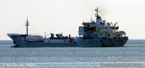
Vessel profile: Islas Dos is a Cement Carrier with dimensions 84m x 84m.
This page combines live AIS, route history, probable destination signals, nearby traffic, and port activity for practical vessel monitoring.
The current position of vessel Islas Dos is 28.97158 lat / -13.52745 lng. Updated: 2026-07-31 13:16:29 UTCNearest reference points:
- Near Lanzarote
- Near LAS COLORADAS
- 56 nm NW of Caleta de Sebo
Currently sailing under the flag of Panama ![]()
Islas Dos built in 1975 year
Deadweight:
5540 tDetails:
Live Vessel Islas Dos Analytics (details, animations, etc.)
Recent AIS points (UTC):
2026-07-31 09:22:31 UTC · 28.97155, -13.52742 · SOG 0 kn · COG 250°2026-07-31 10:16:38 UTC · 28.97155, -13.52743 · SOG 0 kn · COG -1°
2026-07-31 12:01:30 UTC · 28.97155, -13.52742 · SOG 0 kn · COG 250°
2026-07-31 13:16:29 UTC · 28.97158, -13.52745 · SOG 0 kn · COG 250°