 JULIE F
Current Status
Where is the vessel?
JULIE F is currently in 32 nm W of Perula, based on AIS data received about 15h ago.
Latest AIS update:
Current position: 19.42500° N, 105.66500° W (32 nm W of Perula)
Average speed (last 7 days): Loading…
Average speed (last 30 days): Loading…
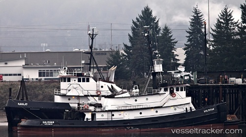
Vessel profile: JULIE F is a Tug with dimensions 10m x 100m.
This page combines live AIS, route history, probable destination signals, nearby traffic, and port activity for practical vessel monitoring.
The current position of vessel JULIE F is 19.42500 lat / -105.66500 lng. Updated: 2026-07-02 22:17:03 UTCNearest reference points:
- Near NUEVO VALLARTA
- 35 nm S of Nayarit
- 46 nm S of El Ranchito
Currently sailing under the flag of United States of America ![]()
JULIE F built in 1973 year
Deadweight:
0 tDetails:
Live Vessel JULIE F Analytics (details, animations, etc.)
Recent AIS points (UTC):
2026-07-02 19:49:34 UTC · 19.27565, -105.44257 · SOG 6.5 kn · COG 303°2026-07-02 20:21:34 UTC · 19.30599, -105.49242 · SOG 6.3 kn · COG 304°
2026-07-02 21:20:05 UTC · 19.36500, -105.58167 · SOG 6 kn · COG -1°
2026-07-02 22:17:03 UTC · 19.42500, -105.66500 · SOG 6 kn · COG -1°