 vesseltracker.com
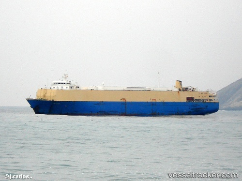
 Elevation
Current Status
Where is the vessel?
Elevation is currently in Near Vila do Conde Pt/Barcarena, based on AIS data received about 14h ago.
Latest AIS update:
Current position: 1.49843° S, 48.77003° W (Near Vila do Conde Pt/Barcarena)
Average speed (last 7 days): Loading…
Average speed (last 30 days): Loading…
Vessel profile: Elevation is a Livestock Carrier with dimensions 187m x 187m.
This page combines live AIS, route history, probable destination signals, nearby traffic, and port activity for practical vessel monitoring.
The current position of vessel Elevation is -1.49843 lat / -48.77003 lng. Updated: 2026-05-18 07:59:38 UTCNearest reference points:
- Near Belem
- 55 nm N of Tucuma
- Near Santana
Currently sailing under the flag of Lebanon ![]()
Elevation built in 1976 year
Deadweight:
8405 tDetails:
Live Vessel Elevation Analytics (details, animations, etc.)
Recent AIS points (UTC):
2026-05-18 04:56:33 UTC · -1.49939, -48.77182 · SOG 0 kn · COG 54°2026-05-18 06:14:34 UTC · -1.49920, -48.77181 · SOG 0.1 kn · COG 95°
2026-05-18 07:56:43 UTC · -1.49846, -48.77023 · SOG 0.2 kn · COG 200°
2026-05-18 07:59:38 UTC · -1.49843, -48.77003 · SOG 0.2 kn · COG 202°