Rachel J
Current StatusWhere is the vessel?
Rachel J is currently in Near Lome, based on AIS data received about 14h ago.
Latest AIS update:
Current position: 6.01826° N, 1.22245° E (Near Lome)
Average speed (last 7 days): Loading…
Average speed (last 30 days): Loading…
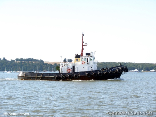
Vessel profile: Rachel J is a Tug with dimensions 10m x 35m.
This page combines live AIS, route history, probable destination signals, nearby traffic, and port activity for practical vessel monitoring.
The current position of vessel Rachel J is 6.01826 lat / 1.22245 lng. Updated: 2026-06-13 09:36:50 UTCNearest reference points:
- Near Ablogamé
- Near Cotonou
- Near Kirikiri
Details:
Live Vessel Rachel J Analytics (details, animations, etc.)
Recent AIS points (UTC):
2026-06-13 05:23:11 UTC · 6.12091, 1.29015 · SOG 3.7 kn · COG -1°2026-06-13 08:00:58 UTC · 6.04179, 1.24195 · SOG 0.9 kn · COG -1°
2026-06-13 08:29:02 UTC · 6.04320, 1.24123 · SOG 0.8 kn · COG -1°
2026-06-13 09:36:50 UTC · 6.01826, 1.22245 · SOG 4.3 kn · COG -1°