 vesseltracker.com
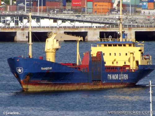
 Danstar
Current Status
Where is the vessel?
Danstar is currently in Near Valparaiso, based on AIS data received less than 1h ago.
Latest AIS update:
Current position: 33.03688° S, 71.62657° W (Near Valparaiso)
Average speed (last 7 days): Loading…
Average speed (last 30 days): Loading…
Vessel profile: Danstar is a General Cargo Ship with dimensions 72m x 13m.
This page combines live AIS, route history, probable destination signals, nearby traffic, and port activity for practical vessel monitoring.
The current position of vessel Danstar is -33.03688 lat / -71.62657 lng. Updated: 2026-05-16 05:53:45 UTCNearest reference points:
- Near Valparaiso
- 28 nm W of Pichilemu
- 100 nm W of Curauma
Currently sailing under the flag of Chile ![]()
Danstar built in 1976 year
Deadweight:
1389 tDetails:
Live Vessel Danstar Analytics (details, animations, etc.)
Recent AIS points (UTC):
2026-05-16 02:33:41 UTC · -33.03667, -71.62500 · SOG 0 kn · COG -1°2026-05-16 04:03:40 UTC · -33.03667, -71.62500 · SOG 0 kn · COG -1°
2026-05-16 04:15:41 UTC · -33.03667, -71.62500 · SOG 0 kn · COG -1°
2026-05-16 05:53:45 UTC · -33.03688, -71.62657 · SOG 0 kn · COG 13°