 Viking
Current Status
Where is the vessel?
Viking is currently in Near Ekonomiya, based on AIS data received about 18h ago.
Latest AIS update:
Current position: 64.63517° N, 40.51985° E (Near Ekonomiya)
Average speed (last 7 days): Loading…
Average speed (last 30 days): Loading…
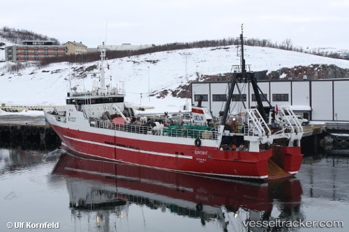
Vessel profile: Viking is a Fishing Vessel with dimensions 63m x 11m.
This page combines live AIS, route history, probable destination signals, nearby traffic, and port activity for practical vessel monitoring.
The current position of vessel Viking is 64.63517 lat / 40.51985 lng. Updated: 2026-07-03 03:14:52 UTCNearest reference points:
- Near Ekonomiya
- Near ARKHANGELSK
- Near Arkhangel’Sk
Currently sailing under the flag of Russia ![]()
Viking built in 1976 year
Deadweight:
265 tDetails:
Live Vessel Viking Analytics (details, animations, etc.)
Recent AIS points (UTC):
2026-07-03 03:14:52 UTC · 64.63517, 40.51985 · SOG 1.4 kn · COG 98°2026-07-03 03:14:52 UTC · 64.63517, 40.51985 · SOG 1.4 kn · COG 98°
2026-07-03 03:14:52 UTC · 64.63517, 40.51985 · SOG 1.4 kn · COG 98°
2026-07-03 03:14:52 UTC · 64.63517, 40.51985 · SOG 1.4 kn · COG 98°