 Mv Dida
Current Status
Where is the vessel?
Mv Dida is currently in Near Kiziltoprak, based on AIS data received about 14h ago.
Latest AIS update:
Current position: 40.99931° N, 29.01672° E (Near Kiziltoprak)
Average speed (last 7 days): Loading…
Average speed (last 30 days): Loading…
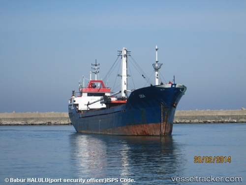
Vessel profile: Mv Dida is a General Cargo Ship with dimensions 70m x 9m.
This page combines live AIS, route history, probable destination signals, nearby traffic, and port activity for practical vessel monitoring.
The current position of vessel Mv Dida is 40.99931 lat / 29.01672 lng. Updated: 2026-05-24 13:48:47 UTCNearest reference points:
- Near Kiziltoprak
- Near Uskudar
- Near Kabatas
Currently sailing under the flag of Turkey ![]()
Mv Dida built in 1976 year
Deadweight:
1468 tDetails:
Live Vessel Mv Dida Analytics (details, animations, etc.)
Recent AIS points (UTC):
2026-05-24 11:03:46 UTC · 40.94252, 28.99436 · SOG 4 kn · COG -1°2026-05-24 12:10:07 UTC · 40.99901, 29.01618 · SOG 0.3 kn · COG -1°
2026-05-24 13:33:15 UTC · 40.99935, 29.01668 · SOG 0 kn · COG -1°
2026-05-24 13:48:47 UTC · 40.99931, 29.01672 · SOG 0 kn · COG -1°