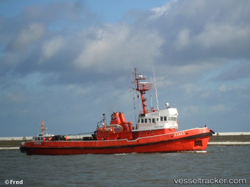
Ambrus
Current StatusWhere is the vessel?
Ambrus is currently in 20 nm NE of Putian, based on AIS data received about 15h ago.
Latest AIS update:
Current position: 24.72442° N, 119.19928° E (20 nm NE of Putian)
Average speed (last 7 days): Loading…
Average speed (last 30 days): Loading…
Vessel profile: Ambrus is a Tug with dimensions 9m x 35m.
This page combines live AIS, route history, probable destination signals, nearby traffic, and port activity for practical vessel monitoring.
The current position of vessel Ambrus is 24.72442 lat / 119.19928 lng. Updated: 2026-05-21 04:16:43 UTCNearest reference points:
- 23 nm SE of XIUYU
- 17 nm E of Xiangzhi
- 19 nm NE of Putian
Details:
Live Vessel Ambrus Analytics (details, animations, etc.)
Recent AIS points (UTC):
2026-05-21 01:55:02 UTC · 24.92957, 119.47272 · SOG 8.2 kn · COG 231°2026-05-21 02:36:23 UTC · 24.86835, 119.39532 · SOG 8 kn · COG 236°
2026-05-21 03:59:03 UTC · 24.75011, 119.23412 · SOG 8.3 kn · COG 235°
2026-05-21 04:16:43 UTC · 24.72442, 119.19928 · SOG 8.3 kn · COG 234°