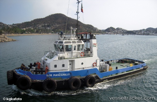
 ST MANZANILLO
Current Status
Where is the vessel?
ST MANZANILLO is currently in Near Bayovar, based on AIS data received about 15h ago.
Latest AIS update:
Current position: 5.80167° S, 81.04167° W (Near Bayovar)
Average speed (last 7 days): Loading…
Average speed (last 30 days): Loading…
Vessel profile: ST MANZANILLO is a Tug with dimensions 8m x 31m.
This page combines live AIS, route history, probable destination signals, nearby traffic, and port activity for practical vessel monitoring.
The current position of vessel ST MANZANILLO is -5.80167 lat / -81.04167 lng. Updated: 2026-05-20 07:26:49 UTCNearest reference points:
- Near PAITA
- 75 nm SW of Talara
Currently sailing under the flag of Peru ![]()
ST MANZANILLO built in 1999 year
Deadweight:
223 tDetails:
Live Vessel ST MANZANILLO Analytics (details, animations, etc.)
Recent AIS points (UTC):
2026-05-20 04:29:45 UTC · -5.80167, -81.04167 · SOG 0 kn · COG -1°2026-05-20 05:47:51 UTC · -5.80167, -81.04167 · SOG 0 kn · COG -1°
2026-05-20 07:20:49 UTC · -5.80167, -81.04167 · SOG 0 kn · COG -1°
2026-05-20 07:26:49 UTC · -5.80167, -81.04167 · SOG 0 kn · COG -1°