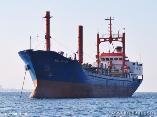
 Haci Rustu K
Current Status
Where is the vessel?
Haci Rustu K is currently in Near YALOVA, based on AIS data received about 14h ago.
Latest AIS update:
Current position: 40.72390° N, 29.48240° E (Near YALOVA)
Average speed (last 7 days): Loading…
Average speed (last 30 days): Loading…
Vessel profile: Haci Rustu K is a General Cargo Ship with dimensions 80m x 80m.
This page combines live AIS, route history, probable destination signals, nearby traffic, and port activity for practical vessel monitoring.
The current position of vessel Haci Rustu K is 40.72390 lat / 29.48240 lng. Updated: 2026-07-08 12:08:25 UTCNearest reference points:
- Near YALOVA
- Near Yilport
- Near Diliskelesi
Currently sailing under the flag of Turkey ![]()
Haci Rustu K built in 1987 year
Deadweight:
2970 tDetails:
Live Vessel Haci Rustu K Analytics (details, animations, etc.)
Recent AIS points (UTC):
2026-07-08 09:36:44 UTC · 40.72414, 29.48233 · SOG 0 kn · COG 328°2026-07-08 09:49:14 UTC · 40.72396, 29.48241 · SOG 0 kn · COG 328°
2026-07-08 11:35:24 UTC · 40.72388, 29.48230 · SOG 0 kn · COG 328°
2026-07-08 12:08:25 UTC · 40.72390, 29.48240 · SOG 0 kn · COG 329°