 AL BARAKA
Current Status
Where is the vessel?
AL BARAKA is currently in Near Nouakchott, based on AIS data received about 14h ago.
Latest AIS update:
Current position: 17.99002° N, 16.03593° W (Near Nouakchott)
Average speed (last 7 days): Loading…
Average speed (last 30 days): Loading…
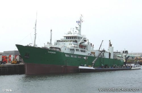
Vessel profile: AL BARAKA is a Factory Trawler with dimensions m x m.
This page combines live AIS, route history, probable destination signals, nearby traffic, and port activity for practical vessel monitoring.
The current position of vessel AL BARAKA is 17.99002 lat / -16.03593 lng. Updated: 2026-05-20 11:39:41 UTCNearest reference points:
- 90 nm W of Nouakchott
- 96 nm NW of Nouakchott
- 100 nm NW of Saint Louis
Currently sailing under the flag of Oman ![]()
Details:
Live Vessel AL BARAKA Analytics (details, animations, etc.)
Recent AIS points (UTC):
2026-05-20 07:28:43 UTC · 17.99002, -16.03592 · SOG 0 kn · COG 239°2026-05-20 09:54:01 UTC · 17.99003, -16.03592 · SOG 0 kn · COG 239°
2026-05-20 10:34:39 UTC · 17.99004, -16.03590 · SOG 0 kn · COG 241°
2026-05-20 11:39:41 UTC · 17.99002, -16.03593 · SOG 0 kn · COG 241°