 vesseltracker.com
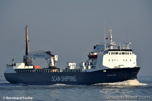
 Karmsund
Current Status
Where is the vessel?
Karmsund is currently in Near Rypefjord, based on AIS data received less than 1h ago.
Latest AIS update:
Current position: 70.62630° N, 23.65610° E (Near Rypefjord)
Average speed (last 7 days): Loading…
Average speed (last 30 days): Loading…
Vessel profile: Karmsund is a Palletized Cargo Ship with dimensions 90m x 14m.
This page combines live AIS, route history, probable destination signals, nearby traffic, and port activity for practical vessel monitoring.
The current position of vessel Karmsund is 70.62630 lat / 23.65610 lng. Updated: 2026-05-12 22:16:53 UTCNearest reference points:
- Near RYPEFJORD
- Near Hammerfest
- Near Repparfjord
Currently sailing under the flag of Denmark ![]()
Karmsund built in 1979 year
Deadweight:
2020 tDetails:
Live Vessel Karmsund Analytics (details, animations, etc.)
Recent AIS points (UTC):
2026-05-12 17:43:08 UTC · 70.51103, 22.90219 · SOG 11.8 kn · COG 75°2026-05-12 19:40:27 UTC · 70.62772, 23.65436 · SOG 0 kn · COG 154°
2026-05-12 19:52:52 UTC · 70.62771, 23.65438 · SOG 0 kn · COG 158°
2026-05-12 22:16:53 UTC · 70.62630, 23.65610 · SOG 0 kn · COG 159°