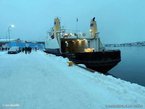
 Ramtind
Current Status
Where is the vessel?
Ramtind is currently in Near Dolmøy, based on AIS data received about 14h ago.
Latest AIS update:
Current position: 63.63837° N, 8.80417° E (Near Dolmøy)
Average speed (last 7 days): Loading…
Average speed (last 30 days): Loading…
Vessel profile: Ramtind is a Passenger Ro Ro Cargo Ship with dimensions 47m x 12m.
This page combines live AIS, route history, probable destination signals, nearby traffic, and port activity for practical vessel monitoring.
The current position of vessel Ramtind is 63.63837 lat / 8.80417 lng. Updated: 2026-05-19 21:39:56 UTCNearest reference points:
- Near Dolmøy
- Near Siholmen
- Near Dyrvik
Currently sailing under the flag of Norway ![]()
Ramtind built in 1979 year
Deadweight:
100 tDetails:
Live Vessel Ramtind Analytics (details, animations, etc.)
Recent AIS points (UTC):
2026-05-19 17:24:17 UTC · 63.63838, 8.80423 · SOG 0 kn · COG 271°2026-05-19 19:27:56 UTC · 63.63837, 8.80417 · SOG 0 kn · COG 271°
2026-05-19 19:33:56 UTC · 63.63837, 8.80418 · SOG 0 kn · COG 271°
2026-05-19 21:39:56 UTC · 63.63837, 8.80417 · SOG 0 kn · COG 271°