 vesseltracker.com
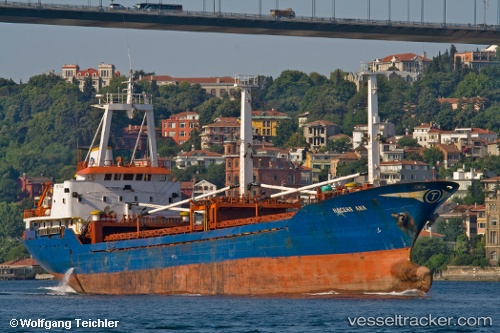
 Hacereana
Current Status
Where is the vessel?
Hacereana is currently in Near Erdemir, based on AIS data received less than 1h ago.
Latest AIS update:
Current position: 41.26479° N, 31.41455° E (Near Erdemir)
Average speed (last 7 days): Loading…
Average speed (last 30 days): Loading…
Vessel profile: Hacereana is a General Cargo Ship with dimensions 81m x 11m.
This page combines live AIS, route history, probable destination signals, nearby traffic, and port activity for practical vessel monitoring.
The current position of vessel Hacereana is 41.26479 lat / 31.41455 lng. Updated: 2026-05-16 07:21:59 UTCNearest reference points:
- Near Erdemir
- Near Derince
- Near AUTOPORT
Currently sailing under the flag of Turkey ![]()
Hacereana built in 1980 year
Deadweight:
3178 tDetails:
Live Vessel Hacereana Analytics (details, animations, etc.)
Recent AIS points (UTC):
2026-05-16 03:21:52 UTC · 41.26016, 31.38028 · SOG 0 kn · COG 331°2026-05-16 03:21:52 UTC · 41.26016, 31.38028 · SOG 0 kn · COG 331°
2026-05-16 05:45:51 UTC · 41.26038, 31.38041 · SOG 0 kn · COG 176°
2026-05-16 07:21:59 UTC · 41.26479, 31.41455 · SOG 0 kn · COG 166°