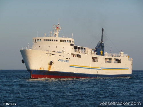
 Evia Star
Current Status
Where is the vessel?
Evia Star is currently in Near Marmari, based on AIS data received about 14h ago.
Latest AIS update:
Current position: 38.04821° N, 24.31748° E (Near Marmari)
Average speed (last 7 days): Loading…
Average speed (last 30 days): Loading…
Vessel profile: Evia Star is a Passenger Ro Ro Cargo Ship with dimensions 87m x 15m.
This page combines live AIS, route history, probable destination signals, nearby traffic, and port activity for practical vessel monitoring.
The current position of vessel Evia Star is 38.04821 lat / 24.31748 lng. Updated: 2026-05-21 07:21:25 UTCNearest reference points:
- Near Agia Marina Grammatikou Attikis
- Near LAVRIO
- Near LAVRIO MARINA
Currently sailing under the flag of Greece ![]()
Evia Star built in 1980 year
Deadweight:
940 tDetails:
Live Vessel Evia Star Analytics (details, animations, etc.)
Recent AIS points (UTC):
2026-05-21 03:53:37 UTC · 38.04195, 24.28639 · SOG 14 kn · COG -1°2026-05-21 04:36:38 UTC · 38.02361, 24.06981 · SOG 14.4 kn · COG -1°
2026-05-21 05:21:54 UTC · 38.02243, 24.01134 · SOG 0 kn · COG -1°
2026-05-21 07:21:25 UTC · 38.04821, 24.31748 · SOG 0 kn · COG -1°