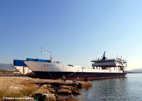
 Maria T
Current Status
Where is the vessel?
Maria T is currently in 18 nm S of Palaiá Fókaia, based on AIS data received about 14h ago.
Latest AIS update:
Current position: 37.41232° N, 23.90333° E (18 nm S of Palaiá Fókaia)
Average speed (last 7 days): Loading…
Average speed (last 30 days): Loading…
Vessel profile: Maria T is a Passenger Ro Ro Cargo Ship with dimensions 73m x 14m.
This page combines live AIS, route history, probable destination signals, nearby traffic, and port activity for practical vessel monitoring.
The current position of vessel Maria T is 37.41232 lat / 23.90333 lng. Updated: 2026-05-21 02:03:41 UTCNearest reference points:
- Near Methana
- Near LAVRIO MARINA
- Near LAVRIO
Currently sailing under the flag of Greece ![]()
Maria T built in 1979 year
Deadweight:
446 tDetails:
Live Vessel Maria T Analytics (details, animations, etc.)
Recent AIS points (UTC):
2026-05-20 22:15:51 UTC · 36.87758, 24.31296 · SOG 10 kn · COG -1°2026-05-21 00:19:20 UTC · 37.17276, 24.09731 · SOG 9.7 kn · COG -1°
2026-05-21 01:02:20 UTC · 37.27100, 24.01692 · SOG 9.7 kn · COG -1°
2026-05-21 02:03:41 UTC · 37.41232, 23.90333 · SOG 9.8 kn · COG -1°