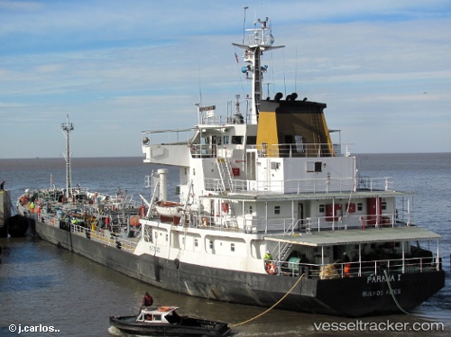
Paranai
Current StatusWhere is the vessel?
Paranai is currently in Near San Pedro, based on AIS data received about 14h ago.
Latest AIS update:
Current position: 33.59970° S, 59.79518° W (Near San Pedro)
Average speed (last 7 days): Loading…
Average speed (last 30 days): Loading…
Vessel profile: Paranai is a Oil Products Tanker with dimensions 19m x 104m.
This page combines live AIS, route history, probable destination signals, nearby traffic, and port activity for practical vessel monitoring.
The current position of vessel Paranai is -33.59970 lat / -59.79518 lng. Updated: 2026-05-21 04:46:12 UTCNearest reference points:
- 10 nm NW of San Pedro
- Near Quebracho/San Lorenzo
- Near Puerto Alumbrera
Details:
Live Vessel Paranai Analytics (details, animations, etc.)
Recent AIS points (UTC):
2026-05-21 01:59:43 UTC · -33.65514, -59.56083 · SOG 5.7 kn · COG 212°2026-05-21 02:01:13 UTC · -33.65714, -59.56244 · SOG 5.7 kn · COG 212°
2026-05-21 04:11:44 UTC · -33.62820, -59.74029 · SOG 6 kn · COG 283°
2026-05-21 04:46:12 UTC · -33.59970, -59.79518 · SOG 5.6 kn · COG 304°