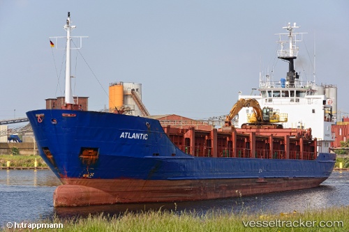
 Atlantic
Current Status
Where is the vessel?
Atlantic is currently in Near Claxton Bay, based on AIS data received about 14h ago.
Latest AIS update:
Current position: 10.34977° N, 61.46307° W (Near Claxton Bay)
Average speed (last 7 days): Loading…
Average speed (last 30 days): Loading…
Vessel profile: Atlantic is a Aggregates Carrier with dimensions 80m x 13m.
This page combines live AIS, route history, probable destination signals, nearby traffic, and port activity for practical vessel monitoring.
The current position of vessel Atlantic is 10.34977 lat / -61.46307 lng. Updated: 2026-05-20 13:19:51 UTCNearest reference points:
- Near POINT LISAS
- Near Caroni
- Near Carenage
Currently sailing under the flag of St Kitts Nevis ![]()
Atlantic built in 1980 year
Deadweight:
3041 tDetails:
Live Vessel Atlantic Analytics (details, animations, etc.)
Recent AIS points (UTC):
2026-05-20 09:58:52 UTC · 10.34975, -61.46308 · SOG 0 kn · COG 350°2026-05-20 10:40:51 UTC · 10.34977, -61.46303 · SOG 0 kn · COG 350°
2026-05-20 12:25:52 UTC · 10.34978, -61.46303 · SOG 0 kn · COG 350°
2026-05-20 13:19:51 UTC · 10.34977, -61.46307 · SOG 0 kn · COG 350°