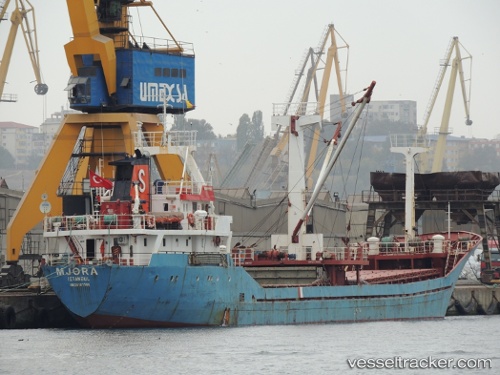
 JORA
JORA
Current Status
Where is the vessel?
JORA is currently in Near Davutpasa, based on AIS data received about 1291d ago.
Latest AIS update:
Current position: 40.97621° N, 28.92962° E (Near Davutpasa)
Average speed (last 7 days): Loading…
Average speed (last 30 days): Loading…
Vessel profile: JORA is a General Cargo Ship with dimensions 77m x 10m.
This page combines live AIS, route history, probable destination signals, nearby traffic, and port activity for practical vessel monitoring.
The current position of vessel JORA is 40.97621 lat / 28.92962 lng. Updated: 2022-11-10 06:35:11 UTCNearest reference points:
- Near Davutpasa
- Near ZEYTINBURNU
- Near Mardas
Currently sailing under the flag of Equatorial Guinea ![]()
JORA built in 1983 year
Deadweight:
1619 tDetails:
Live Vessel JORA Analytics (details, animations, etc.)
Recent AIS points (UTC):
2022-11-10 06:35:11 UTC · 40.97621, 28.92962 · SOG 0.1 kn · COG 311°