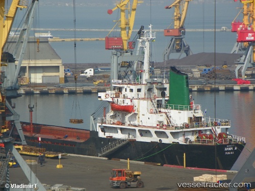
 RAMA H
Current Status
Where is the vessel?
RAMA H is currently in 58 nm E of IGNEADA, based on AIS data received about 16d ago.
Latest AIS update:
Current position: 42.22323° N, 29.23424° E (58 nm E of IGNEADA)
Average speed (last 7 days): Loading…
Average speed (last 30 days): Loading…
Vessel profile: RAMA H is a General Cargo Ship with dimensions 27m x 109m.
This page combines live AIS, route history, probable destination signals, nearby traffic, and port activity for practical vessel monitoring.
The current position of vessel RAMA H is 42.22323 lat / 29.23424 lng. Updated: 2026-05-05 05:09:05 UTCNearest reference points:
- 45 nm N of RUMELI FENERI
- 38 nm E of IGNEADA
- 54 nm SE of Sveti Nikola
Currently sailing under the flag of Honduras ![]()
RAMA H built in 1982 year
Deadweight:
8214 tDetails:
Live Vessel RAMA H Analytics (details, animations, etc.)
Recent AIS points (UTC):
2026-05-05 05:09:05 UTC · 42.22323, 29.23424 · SOG 9.1 kn · COG 9°