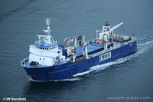
 SOUTHERN LINER
Current Status
Where is the vessel?
SOUTHERN LINER is currently in 40 nm W of Offshore Tui, based on AIS data received about 368d ago.
Latest AIS update:
Current position: 39.35144° S, 172.36674° E (40 nm W of Offshore Tui)
Average speed (last 7 days): Loading…
Average speed (last 30 days): Loading…
Vessel profile: SOUTHERN LINER is a General Cargo Ship with dimensions 56m x 13m.
This page combines live AIS, route history, probable destination signals, nearby traffic, and port activity for practical vessel monitoring.
The current position of vessel SOUTHERN LINER is -39.35144 lat / 172.36674 lng. Updated: 2025-05-17 10:14:06 UTCNearest reference points:
- Near Nelson
- Near WAIKAWA
- Near Renwick
Currently sailing under the flag of Panama ![]()
SOUTHERN LINER built in 1982 year
Deadweight:
840 tDetails:
Live Vessel SOUTHERN LINER Analytics (details, animations, etc.)
Recent AIS points (UTC):
2025-05-17 10:14:06 UTC · -39.35144, 172.36674 · SOG 1.8 kn · COG 137°