 vesseltracker.com
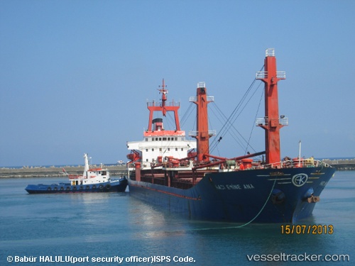
 HACI EMINE ANA
Current Status
Where is the vessel?
HACI EMINE ANA is currently in Near Mykolaiv, based on AIS data received about 182d ago.
Latest AIS update:
Current position: 46.94519° N, 32.01245° E (Near Mykolaiv)
Average speed (last 7 days): Loading…
Average speed (last 30 days): Loading…
Vessel profile: HACI EMINE ANA is a General Cargo Ship with dimensions 117m x 16m.
This page combines live AIS, route history, probable destination signals, nearby traffic, and port activity for practical vessel monitoring.
The current position of vessel HACI EMINE ANA is 46.94519 lat / 32.01245 lng. Updated: 2025-10-06 11:07:06 UTCNearest reference points:
- Near Olviia
- 45 nm W of Krasne
- Near Illichivs’K
Currently sailing under the flag of Palau (Republic of) ![]()
HACI EMINE ANA built in 1984 year
Deadweight:
8170 tDetails:
Live Vessel HACI EMINE ANA Analytics (details, animations, etc.)
Recent AIS points (UTC):
2025-10-06 11:07:06 UTC · 46.94519, 32.01245 · SOG 0 kn · COG -1°