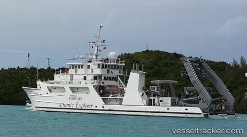
Atlantic Explorer
Current StatusWhere is the vessel?
Atlantic Explorer is currently in 115 nm NW of Efpalion, based on AIS data received about 14h ago.
Latest AIS update:
Current position: 24.05665° N, 39.93812° W (115 nm NW of Efpalion)
Average speed (last 7 days): Loading…
Average speed (last 30 days): Loading…
Vessel profile: Atlantic Explorer is a Research Vessel with dimensions 12m x 51m.
This page combines live AIS, route history, probable destination signals, nearby traffic, and port activity for practical vessel monitoring.
The current position of vessel Atlantic Explorer is 24.05665 lat / -39.93812 lng. Updated: 2026-05-21 01:50:28 UTCNearest reference points:
- 126 nm W of Efpalion
Details:
Live Vessel Atlantic Explorer Analytics (details, animations, etc.)
Recent AIS points (UTC):
2026-05-20 22:19:20 UTC · 24.16667, -40.21667 · SOG 0 kn · COG -1°2026-05-20 23:57:02 UTC · 24.17099, -40.21515 · SOG 0.1 kn · COG 112°
2026-05-21 01:34:21 UTC · 24.07333, -39.98333 · SOG 10 kn · COG -1°
2026-05-21 01:50:28 UTC · 24.05665, -39.93812 · SOG 9.8 kn · COG 114°