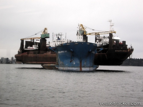
 Development Way
Current Status
Where is the vessel?
Development Way is currently in Near Trincomalee, based on AIS data received about 14h ago.
Latest AIS update:
Current position: 8.53255° N, 81.22581° E (Near Trincomalee)
Average speed (last 7 days): Loading…
Average speed (last 30 days): Loading…
Vessel profile: Development Way is a Heavy Load Carrier with dimensions 215m x 215m.
This page combines live AIS, route history, probable destination signals, nearby traffic, and port activity for practical vessel monitoring.
The current position of vessel Development Way is 8.53255 lat / 81.22581 lng. Updated: 2026-05-21 03:47:56 UTCNearest reference points:
- 67 nm E of Oluvil
- 42 nm E of Konwelana
- 40 nm E of Konwelana
Currently sailing under the flag of Panama ![]()
Development Way built in 1983 year
Deadweight:
31287 tDetails:
Live Vessel Development Way Analytics (details, animations, etc.)
Recent AIS points (UTC):
2026-05-20 23:41:58 UTC · 8.53258, 81.22570 · SOG 0 kn · COG 262°2026-05-21 01:23:58 UTC · 8.53237, 81.22577 · SOG 0 kn · COG 270°
2026-05-21 02:20:55 UTC · 8.53238, 81.22581 · SOG 0 kn · COG 268°
2026-05-21 03:47:56 UTC · 8.53255, 81.22581 · SOG 0 kn · COG 262°