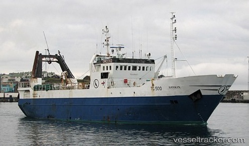
Rankin
Current StatusWhere is the vessel?
Rankin is currently in 48 nm SE of Vágur, based on AIS data received about 14h ago.
Latest AIS update:
Current position: 60.76018° N, 6.04849° W (48 nm SE of Vágur)
Average speed (last 7 days): Loading…
Average speed (last 30 days): Loading…
Vessel profile: Rankin is a Fishing Vessel with dimensions 10m x 46m.
This page combines live AIS, route history, probable destination signals, nearby traffic, and port activity for practical vessel monitoring.
The current position of vessel Rankin is 60.76018 lat / -6.04849 lng. Updated: 2026-05-20 13:36:00 UTCNearest reference points:
- 20 nm S of Vágur
- Near FUGLAFJORDUR
- Near VESTMANNA
Details:
Live Vessel Rankin Analytics (details, animations, etc.)
Recent AIS points (UTC):
2026-05-20 10:36:04 UTC · 60.82048, -5.81847 · SOG 2.3 kn · COG 256°2026-05-20 11:40:00 UTC · 60.81676, -5.91704 · SOG 2.9 kn · COG 261°
2026-05-20 13:22:01 UTC · 60.77145, -6.03953 · SOG 3.2 kn · COG 210°
2026-05-20 13:36:00 UTC · 60.76018, -6.04849 · SOG 3.1 kn · COG 209°