 vesseltracker.com
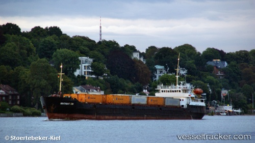
 VOLGO BALT 239
Current Status
Where is the vessel?
VOLGO BALT 239 is currently in 20 nm SW of Kuryk, based on AIS data received less than 1h ago.
Latest AIS update:
Current position: 43.05925° N, 51.23935° E (20 nm SW of Kuryk)
Average speed (last 7 days): Loading…
Average speed (last 30 days): Loading…
Vessel profile: VOLGO BALT 239 is a General Cargo with dimensions 114m x 13m.
This page combines live AIS, route history, probable destination signals, nearby traffic, and port activity for practical vessel monitoring.
The current position of vessel VOLGO BALT 239 is 43.05925 lat / 51.23935 lng. Updated: 2026-05-13 19:54:19 UTCNearest reference points:
- 24 nm W of Kuryk
- 29 nm SW of Kuryk
- 35 nm W of Kuryk
Currently sailing under the flag of Russia ![]()
VOLGO BALT 239 built in 1982 year
Deadweight:
3510 tDetails:
Live Vessel VOLGO BALT 239 Analytics (details, animations, etc.)
Recent AIS points (UTC):
2026-05-13 15:36:25 UTC · 42.78167, 51.71167 · SOG 6 kn · COG -1°2026-05-13 17:27:24 UTC · 42.93500, 51.54333 · SOG 4 kn · COG -1°
2026-05-13 19:43:01 UTC · 43.04168, 51.25873 · SOG 7.3 kn · COG -1°
2026-05-13 19:54:19 UTC · 43.05925, 51.23935 · SOG 7.2 kn · COG -1°