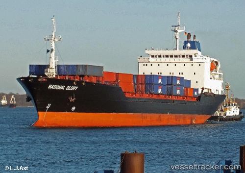
National Glory
Current StatusWhere is the vessel?
National Glory is currently in 82 nm NW of Yucatan Channel, based on AIS data received about 14h ago.
Latest AIS update:
Current position: 22.70833° N, 86.19167° W (82 nm NW of Yucatan Channel)
Average speed (last 7 days): Loading…
Average speed (last 30 days): Loading…
Vessel profile: National Glory is a Container Ship with dimensions 22m x 149m.
This page combines live AIS, route history, probable destination signals, nearby traffic, and port activity for practical vessel monitoring.
The current position of vessel National Glory is 22.70833 lat / -86.19167 lng. Updated: 2026-05-23 00:10:59 UTCNearest reference points:
- Near Puerto Juárez
- 58 nm S of San Julian
Details:
Live Vessel National Glory Analytics (details, animations, etc.)
Recent AIS points (UTC):
2026-05-22 20:16:05 UTC · 21.82011, -85.42428 · SOG 16.7 kn · COG -1°2026-05-22 20:47:02 UTC · 21.93667, -85.51833 · SOG 17 kn · COG -1°
2026-05-22 23:02:02 UTC · 22.42833, -85.96000 · SOG 17 kn · COG -1°
2026-05-23 00:10:59 UTC · 22.70833, -86.19167 · SOG 19 kn · COG -1°