 FIN WHALE
Current Status
Where is the vessel?
FIN WHALE is currently in 71 nm NW of Nouakchott, based on AIS data received about 15h ago.
Latest AIS update:
Current position: 18.98824° N, 16.76820° W (71 nm NW of Nouakchott)
Average speed (last 7 days): Loading…
Average speed (last 30 days): Loading…
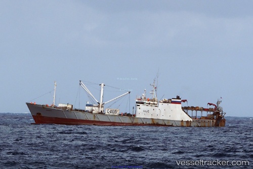
Vessel profile: FIN WHALE is a Trawler with dimensions m x m.
This page combines live AIS, route history, probable destination signals, nearby traffic, and port activity for practical vessel monitoring.
The current position of vessel FIN WHALE is 18.98824 lat / -16.76820 lng. Updated: 2026-05-21 04:07:52 UTCNearest reference points:
- 96 nm NW of Nouakchott
- 90 nm W of Nouakchott
- 108 nm SW of Port Etienne
Currently sailing under the flag of Gambia ![]()
Details:
Live Vessel FIN WHALE Analytics (details, animations, etc.)
Recent AIS points (UTC):
2026-05-21 01:11:48 UTC · 18.77764, -16.62359 · SOG 13.1 kn · COG 299°2026-05-21 01:52:02 UTC · 18.82218, -16.68085 · SOG 5.1 kn · COG 356°
2026-05-21 03:22:03 UTC · 18.93253, -16.73992 · SOG 4.8 kn · COG 326°
2026-05-21 04:07:52 UTC · 18.98824, -16.76820 · SOG 4.8 kn · COG 344°