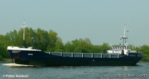
Helga
Current StatusWhere is the vessel?
Helga is currently in 15 nm SW of Nyslott (Savonlinna), based on AIS data received about 14h ago.
Latest AIS update:
Current position: 61.69349° N, 28.52790° E (15 nm SW of Nyslott (Savonlinna))
Average speed (last 7 days): Loading…
Average speed (last 30 days): Loading…
Vessel profile: Helga is a General Cargo Ship with dimensions 11m x 80m.
This page combines live AIS, route history, probable destination signals, nearby traffic, and port activity for practical vessel monitoring.
The current position of vessel Helga is 61.69349 lat / 28.52790 lng. Updated: 2026-05-20 22:15:27 UTCNearest reference points:
- Near Primorsk
- 10 nm SE of Primorsk
- 11 nm NE of VISTINO
Details:
Live Vessel Helga Analytics (details, animations, etc.)
Recent AIS points (UTC):
2026-05-20 18:04:27 UTC · 61.24642, 28.21057 · SOG 9.5 kn · COG 310°2026-05-20 19:32:47 UTC · 61.43672, 28.18848 · SOG 9.8 kn · COG 350°
2026-05-20 21:52:50 UTC · 61.63308, 28.55347 · SOG 9.6 kn · COG 349°
2026-05-20 22:15:27 UTC · 61.69349, 28.52790 · SOG 9.7 kn · COG 351°