 vesseltracker.com
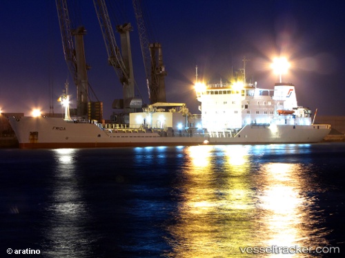
 CEMENT FERRY
Current Status
Where is the vessel?
CEMENT FERRY is currently in 10 nm N of KEA, based on AIS data received about 1h ago.
Latest AIS update:
Current position: 37.82426° N, 24.38055° E (10 nm N of KEA)
Average speed (last 7 days): Loading…
Average speed (last 30 days): Loading…
Vessel profile: CEMENT FERRY is a Cement Carrier with dimensions 17m x 118m.
This page combines live AIS, route history, probable destination signals, nearby traffic, and port activity for practical vessel monitoring.
The current position of vessel CEMENT FERRY is 37.82426 lat / 24.38055 lng. Updated: 2026-05-15 05:38:09 UTCNearest reference points:
- Near Kéa (Tzia)
- Near LAVRIO
- Near LAVRIO MARINA
Currently sailing under the flag of Antigua and Barbuda ![]()
CEMENT FERRY built in 1985 year
Deadweight:
7682 tDetails:
Live Vessel CEMENT FERRY Analytics (details, animations, etc.)
Recent AIS points (UTC):
2026-05-15 01:00:49 UTC · 38.32382, 25.03769 · SOG 9 kn · COG 233°2026-05-15 04:02:19 UTC · 37.98734, 24.62235 · SOG 9.7 kn · COG 222°
2026-05-15 04:17:40 UTC · 37.95561, 24.58808 · SOG 9.7 kn · COG 224°
2026-05-15 05:38:09 UTC · 37.82426, 24.38055 · SOG 8.9 kn · COG 234°