 DARYA MAJU
Current Status
Where is the vessel?
DARYA MAJU is currently in Near Bandjermasin, based on AIS data received about 2d ago.
Latest AIS update:
Current position: 3.46075° S, 114.51038° E (Near Bandjermasin)
Average speed (last 7 days): Loading…
Average speed (last 30 days): Loading…
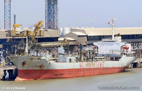
Vessel profile: DARYA MAJU is a Cement Carrier with dimensions 22m x 146m.
This page combines live AIS, route history, probable destination signals, nearby traffic, and port activity for practical vessel monitoring.
The current position of vessel DARYA MAJU is -3.46075 lat / 114.51038 lng. Updated: 2026-05-18 15:22:25 UTCNearest reference points:
- Near BANJARMASIN
- Near Taboneo
- Near Bunati
Currently sailing under the flag of Indonesia ![]()
DARYA MAJU built in 1985 year
Deadweight:
17346 tDetails:
Live Vessel DARYA MAJU Analytics (details, animations, etc.)
Recent AIS points (UTC):
2026-05-18 15:22:25 UTC · -3.46075, 114.51038 · SOG 0 kn · COG -1°2026-05-18 15:22:25 UTC · -3.46075, 114.51038 · SOG 0 kn · COG -1°
2026-05-18 15:22:25 UTC · -3.46075, 114.51038 · SOG 0 kn · COG -1°
2026-05-18 15:22:25 UTC · -3.46075, 114.51038 · SOG 0 kn · COG -1°