 vesseltracker.com
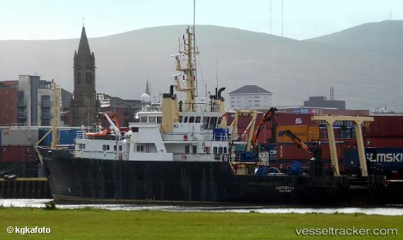
 Corystes
Current Status
Where is the vessel?
Corystes is currently in Near Belfast, based on AIS data received less than 1h ago.
Latest AIS update:
Current position: 54.61224° N, 5.91892° W (Near Belfast)
Average speed (last 7 days): Loading…
Average speed (last 30 days): Loading…
Vessel profile: Corystes is a Fishing Support Vessel with dimensions 53m x 13m.
This page combines live AIS, route history, probable destination signals, nearby traffic, and port activity for practical vessel monitoring.
The current position of vessel Corystes is 54.61224 lat / -5.91892 lng. Updated: 2026-05-16 02:30:55 UTCNearest reference points:
- Near Belfast
- Near Crossgar
- Near KILKEEL
Currently sailing under the flag of United Kingdom ![]()
Corystes built in 1988 year
Deadweight:
284 tDetails:
Live Vessel Corystes Analytics (details, animations, etc.)
Recent AIS points (UTC):
2026-05-15 22:41:00 UTC · 54.61222, -5.91884 · SOG 0 kn · COG 198°2026-05-15 23:42:55 UTC · 54.61220, -5.91895 · SOG 0 kn · COG 197°
2026-05-16 01:54:53 UTC · 54.61216, -5.91880 · SOG 0 kn · COG 197°
2026-05-16 02:30:55 UTC · 54.61224, -5.91892 · SOG 0 kn · COG 197°