 GAL
GAL
Current Status
Where is the vessel?
GAL is currently in 16 nm SE of Rhodes, based on AIS data received about 14h ago.
Latest AIS update:
Current position: 36.34209° N, 28.54376° E (16 nm SE of Rhodes)
Average speed (last 7 days): Loading…
Average speed (last 30 days): Loading…
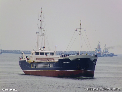
Vessel profile: GAL is a General Cargo with dimensions m x m.
This page combines live AIS, route history, probable destination signals, nearby traffic, and port activity for practical vessel monitoring.
The current position of vessel GAL is 36.34209 lat / 28.54376 lng. Updated: 2026-05-21 13:53:34 UTCNearest reference points:
- 18 nm E of Rhodes
- Near Rhodes
- Near Içmeler
Currently sailing under the flag of Guinea ![]()
Details:
Live Vessel GAL Analytics (details, animations, etc.)
Recent AIS points (UTC):
2026-05-21 10:50:04 UTC · 36.21697, 28.77823 · SOG 4.7 kn · COG 307°2026-05-21 11:25:24 UTC · 36.24086, 28.73137 · SOG 4.2 kn · COG 317°
2026-05-21 13:07:54 UTC · 36.31597, 28.60724 · SOG 4.4 kn · COG 303°
2026-05-21 13:53:34 UTC · 36.34209, 28.54376 · SOG 4.6 kn · COG 298°