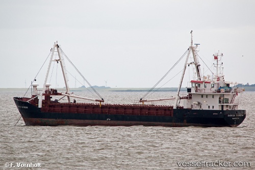
Danica Rainbow
Current StatusWhere is the vessel?
Danica Rainbow is currently in Near Gdynia, based on AIS data received about 15h ago.
Latest AIS update:
Current position: 54.53532° N, 18.52009° E (Near Gdynia)
Average speed (last 7 days): Loading…
Average speed (last 30 days): Loading…
Vessel profile: Danica Rainbow is a General Cargo Ship with dimensions 10m x 66m.
This page combines live AIS, route history, probable destination signals, nearby traffic, and port activity for practical vessel monitoring.
The current position of vessel Danica Rainbow is 54.53532 lat / 18.52009 lng. Updated: 2026-05-23 10:19:10 UTCNearest reference points:
- Near Gdynia
- Near Sopot
- Near Nowy Port/Gdansk
Details:
Live Vessel Danica Rainbow Analytics (details, animations, etc.)
Recent AIS points (UTC):
2026-05-23 07:39:38 UTC · 54.53533, 18.52013 · SOG 0.4 kn · COG -1°2026-05-23 08:00:37 UTC · 54.53532, 18.52025 · SOG 1.1 kn · COG -1°
2026-05-23 10:19:10 UTC · 54.53532, 18.52009 · SOG 0.1 kn · COG -1°
2026-05-23 10:19:10 UTC · 54.53532, 18.52009 · SOG 0.1 kn · COG -1°