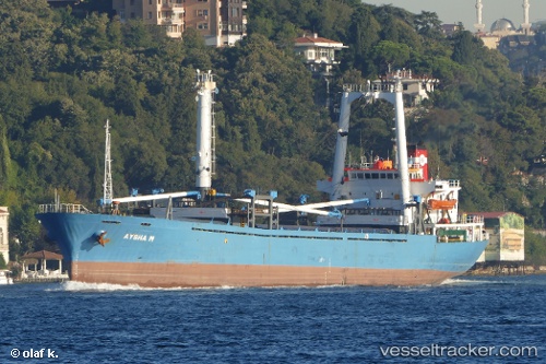
 Aysha M
Current Status
Where is the vessel?
Aysha M is currently in Near Sulina (Port et Zone Franche), based on AIS data received about 13d ago.
Latest AIS update:
Current position: 45.17494° N, 29.85658° E (Near Sulina (Port et Zone Franche))
Average speed (last 7 days): Loading…
Average speed (last 30 days): Loading…
Vessel profile: Aysha M is a General Cargo Ship with dimensions 97m x 18m.
This page combines live AIS, route history, probable destination signals, nearby traffic, and port activity for practical vessel monitoring.
The current position of vessel Aysha M is 45.17494 lat / 29.85658 lng. Updated: 2026-05-07 16:12:20 UTCNearest reference points:
- 12 nm SE of Sulina (Port et Zone Franche)
- 13 nm E of Sulina (Port et Zone Franche)
- Near Ust-Dunaisk/Vylkove
Currently sailing under the flag of Comoros ![]()
Aysha M built in 1985 year
Deadweight:
5628 tDetails:
Live Vessel Aysha M Analytics (details, animations, etc.)
Recent AIS points (UTC):
2026-05-07 16:12:20 UTC · 45.17494, 29.85658 · SOG 0 kn · COG 196°2026-05-07 16:12:20 UTC · 45.17494, 29.85658 · SOG 0 kn · COG 196°
2026-05-07 16:12:20 UTC · 45.17494, 29.85658 · SOG 0 kn · COG 196°
2026-05-07 16:12:20 UTC · 45.17494, 29.85658 · SOG 0 kn · COG 196°