 vesseltracker.com
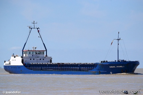
 BMO RIVER
Current Status
Where is the vessel?
BMO RIVER is currently in Near CESME, based on AIS data received less than 1h ago.
Latest AIS update:
Current position: 38.31474° N, 26.25120° E (Near CESME)
Average speed (last 7 days): Loading…
Average speed (last 30 days): Loading…
Vessel profile: BMO RIVER is a General Cargo with dimensions 79m x 11m.
This page combines live AIS, route history, probable destination signals, nearby traffic, and port activity for practical vessel monitoring.
The current position of vessel BMO RIVER is 38.31474 lat / 26.25120 lng. Updated: 2026-05-13 03:50:56 UTCNearest reference points:
- Near CESME
- 13 nm NW of Karkinagri Ikarias
- Near FOURNI
Currently sailing under the flag of Palau ![]()
BMO RIVER built in 1986 year
Deadweight:
1613 tDetails:
Live Vessel BMO RIVER Analytics (details, animations, etc.)
Recent AIS points (UTC):
2026-05-12 23:35:57 UTC · 38.31482, 26.25097 · SOG 0.1 kn · COG 165°2026-05-13 01:29:56 UTC · 38.31479, 26.25102 · SOG 0.4 kn · COG 192°
2026-05-13 02:17:59 UTC · 38.31486, 26.25106 · SOG 0.2 kn · COG 190°
2026-05-13 03:50:56 UTC · 38.31474, 26.25120 · SOG 0 kn · COG 189°