 HANSUNG
Current Status
Where is the vessel?
HANSUNG is currently in 89 nm NE of Dai Hung (Tandem Load), based on AIS data received about 119d ago.
Latest AIS update:
Current position: 9.44167° N, 109.81333° E (89 nm NE of Dai Hung (Tandem Load))
Average speed (last 7 days): Loading…
Average speed (last 30 days): Loading…
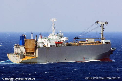
Vessel profile: HANSUNG is a Vehicles Carrier with dimensions 97m x 20m.
This page combines live AIS, route history, probable destination signals, nearby traffic, and port activity for practical vessel monitoring.
The current position of vessel HANSUNG is 9.44167 lat / 109.81333 lng. Updated: 2026-01-21 08:44:27 UTCNearest reference points:
- Near Rang Dong
- 156 nm SE of Phan Rang-Tháp Chàm
- 30 nm SW of Dai Hung (Tandem Load)
Currently sailing under the flag of Togo ![]()
HANSUNG built in 1985 year
Deadweight:
3611 tDetails:
Live Vessel HANSUNG Analytics (details, animations, etc.)
Recent AIS points (UTC):
2026-01-21 08:44:27 UTC · 9.44167, 109.81333 · SOG 8 kn · COG -1°