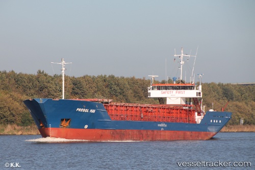
 Pregol Hav
Current Status
Where is the vessel?
Pregol Hav is currently in Near SOEBY, based on AIS data received about 15h ago.
Latest AIS update:
Current position: 54.94315° N, 10.25627° E (Near SOEBY)
Average speed (last 7 days): Loading…
Average speed (last 30 days): Loading…
Vessel profile: Pregol Hav is a Multi Purpose Carrier with dimensions 83m x 11m.
This page combines live AIS, route history, probable destination signals, nearby traffic, and port activity for practical vessel monitoring.
The current position of vessel Pregol Hav is 54.94315 lat / 10.25627 lng. Updated: 2026-05-20 08:06:23 UTCNearest reference points:
- Near Faaborg
- 10 nm E of Brodersby bei Kappeln/Schlei
- Near Brodersby bei Kappeln/Schlei
Currently sailing under the flag of Antigua Barbuda ![]()
Pregol Hav built in 1985 year
Deadweight:
2291 tDetails:
Live Vessel Pregol Hav Analytics (details, animations, etc.)
Recent AIS points (UTC):
2026-05-20 04:43:13 UTC · 54.94315, 10.25627 · SOG 0 kn · COG 281°2026-05-20 06:06:15 UTC · 54.94314, 10.25627 · SOG 0 kn · COG 281°
2026-05-20 07:44:15 UTC · 54.94312, 10.25623 · SOG 0 kn · COG 281°
2026-05-20 08:06:23 UTC · 54.94315, 10.25627 · SOG 0 kn · COG 281°