 vesseltracker.com
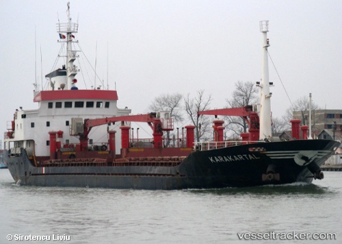
 Karakartal
Current Status
Where is the vessel?
Karakartal is currently in Near Yesilovacik, based on AIS data received about 1h ago.
Latest AIS update:
Current position: 36.09381° N, 33.66678° E (Near Yesilovacik)
Average speed (last 7 days): Loading…
Average speed (last 30 days): Loading…
Vessel profile: Karakartal is a General Cargo Ship with dimensions 87m x 13m.
This page combines live AIS, route history, probable destination signals, nearby traffic, and port activity for practical vessel monitoring.
The current position of vessel Karakartal is 36.09381 lat / 33.66678 lng. Updated: 2026-05-13 20:15:36 UTCNearest reference points:
- 15 nm SW of Yesilovacik
- 20 nm SW of Yesilovacik
- Near Mersin
Currently sailing under the flag of Turkey ![]()
Karakartal built in 1994 year
Deadweight:
3325 tDetails:
Live Vessel Karakartal Analytics (details, animations, etc.)
Recent AIS points (UTC):
2026-05-13 16:13:56 UTC · 36.20830, 34.32046 · SOG 8.4 kn · COG 257°2026-05-13 18:13:56 UTC · 36.14527, 33.98762 · SOG 7.7 kn · COG 264°
2026-05-13 19:14:56 UTC · 36.12028, 33.82720 · SOG 7.8 kn · COG 261°
2026-05-13 20:15:36 UTC · 36.09381, 33.66678 · SOG 7.7 kn · COG 264°