 vesseltracker.com
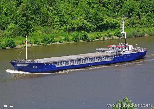
Bonita
Current StatusWhere is the vessel?
Bonita is currently in 11 nm NW of Pendeen, based on AIS data received less than 1h ago.
Latest AIS update:
Current position: 50.30134° N, 5.86817° W (11 nm NW of Pendeen)
Average speed (last 7 days): Loading…
Average speed (last 30 days): Loading…
Vessel profile: Bonita is a General Cargo Ship with dimensions 11m x 66m.
This page combines live AIS, route history, probable destination signals, nearby traffic, and port activity for practical vessel monitoring.
The current position of vessel Bonita is 50.30134 lat / -5.86817 lng. Updated: 2026-05-15 11:47:26 UTCNearest reference points:
- 10 nm NW of Grampound
- Near Isles of Scilly
- 28 nm S of Porthgwarra
Details:
Live Vessel Bonita Analytics (details, animations, etc.)
Recent AIS points (UTC):
2026-05-15 08:15:37 UTC · 49.97366, -5.71323 · SOG 7.1 kn · COG 291°2026-05-15 09:26:36 UTC · 50.03592, -5.86226 · SOG 6 kn · COG 6°
2026-05-15 10:06:27 UTC · 50.10713, -5.86384 · SOG 6.7 kn · COG 1°
2026-05-15 11:47:26 UTC · 50.30134, -5.86817 · SOG 6.6 kn · COG 356°