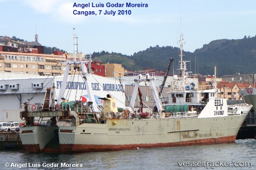
Hermanos Gandon 4
Current StatusWhere is the vessel?
Hermanos Gandon 4 is currently in 262 nm S of Quequen, based on AIS data received about 15h ago.
Latest AIS update:
Current position: 42.61302° S, 56.46831° W (262 nm S of Quequen)
Average speed (last 7 days): Loading…
Average speed (last 30 days): Loading…
Vessel profile: Hermanos Gandon 4 is a Fishing Vessel with dimensions 10m x 67m.
This page combines live AIS, route history, probable destination signals, nearby traffic, and port activity for practical vessel monitoring.
The current position of vessel Hermanos Gandon 4 is -42.61302 lat / -56.46831 lng. Updated: 2026-05-23 02:06:02 UTCNearest reference points:
- 186 nm S of Quequen
- 361 nm SE of Quequen
- Open sea, approx. 405 nm off the nearest listed port
Details:
Live Vessel Hermanos Gandon 4 Analytics (details, animations, etc.)
Recent AIS points (UTC):
2026-05-22 22:59:40 UTC · -42.87468, -56.75845 · SOG 6.5 kn · COG 38°2026-05-23 00:22:03 UTC · -42.76338, -56.62205 · SOG 6.3 kn · COG 35°
2026-05-23 01:02:03 UTC · -42.70590, -56.56081 · SOG 6.5 kn · COG 34°
2026-05-23 02:06:02 UTC · -42.61302, -56.46831 · SOG 6.3 kn · COG 34°