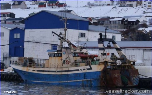
Ametyst
Current StatusWhere is the vessel?
Ametyst is currently in Near Klaksvig, based on AIS data received about 14h ago.
Latest AIS update:
Current position: 62.23663° N, 6.59408° W (Near Klaksvig)
Average speed (last 7 days): Loading…
Average speed (last 30 days): Loading…
Vessel profile: Ametyst is a Fishing Vessel with dimensions 8m x 32m.
This page combines live AIS, route history, probable destination signals, nearby traffic, and port activity for practical vessel monitoring.
The current position of vessel Ametyst is 62.23663 lat / -6.59408 lng. Updated: 2026-05-21 13:37:26 UTCNearest reference points:
- Near FUGLAFJORDUR
- Near VESTMANNA
- 20 nm S of Vágur
Details:
Live Vessel Ametyst Analytics (details, animations, etc.)
Recent AIS points (UTC):
2026-05-21 11:07:17 UTC · 62.37508, -6.69694 · SOG 5 kn · COG 222°2026-05-21 12:27:18 UTC · 62.23665, -6.59407 · SOG 0.1 kn · COG 352°
2026-05-21 13:09:36 UTC · 62.23663, -6.59410 · SOG 0 kn · COG 353°
2026-05-21 13:37:26 UTC · 62.23663, -6.59408 · SOG 0 kn · COG 352°