 vesseltracker.com
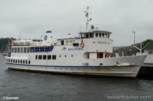
 Sagasund
Current Status
Where is the vessel?
Sagasund is currently in Near Standal, based on AIS data received about 2h ago.
Latest AIS update:
Current position: 62.25313° N, 6.50264° E (Near Standal)
Average speed (last 7 days): Loading…
Average speed (last 30 days): Loading…
Vessel profile: Sagasund is a Passenger Ship with dimensions 35m x 36m.
This page combines live AIS, route history, probable destination signals, nearby traffic, and port activity for practical vessel monitoring.
The current position of vessel Sagasund is 62.25313 lat / 6.50264 lng. Updated: 2026-05-15 01:13:07 UTCNearest reference points:
- Near SPJELKAVIK
- Near Fiskarstrand
- Near Alesund
Currently sailing under the flag of Norway ![]()
Sagasund built in 1964 year
Details:
Live Vessel Sagasund Analytics (details, animations, etc.)
Recent AIS points (UTC):
2026-05-14 21:58:13 UTC · 62.25311, 6.50263 · SOG 0 kn · COG 49°2026-05-14 22:36:03 UTC · 62.25312, 6.50264 · SOG 0 kn · COG 49°
2026-05-14 23:59:24 UTC · 62.25312, 6.50263 · SOG 0 kn · COG 50°
2026-05-15 01:13:07 UTC · 62.25313, 6.50264 · SOG 0 kn · COG 49°