 RAUMA
RAUMA
Current Status
Where is the vessel?
RAUMA is currently in Near Kristiansund, based on AIS data received about 1453d ago.
Latest AIS update:
Current position: 63.11379° N, 7.73671° E (Near Kristiansund)
Average speed (last 7 days): Loading…
Average speed (last 30 days): Loading…
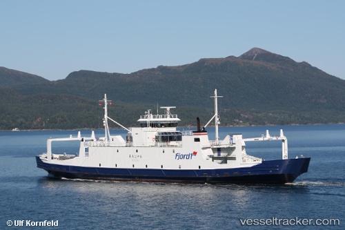
Vessel profile: RAUMA is a Passenger/Ro-Ro Ship (vehicles) with dimensions 82m x 14m.
This page combines live AIS, route history, probable destination signals, nearby traffic, and port activity for practical vessel monitoring.
The current position of vessel RAUMA is 63.11379 lat / 7.73671 lng. Updated: 2022-07-21 08:38:11 UTCNearest reference points:
- Near Kristiansund
- Near Smøla
- Near Halsa
Currently sailing under the flag of Togo ![]()
RAUMA built in 1988 year
Deadweight:
500 tDetails:
Live Vessel RAUMA Analytics (details, animations, etc.)
Recent AIS points (UTC):
2022-07-21 08:38:11 UTC · 63.11379, 7.73671 · SOG 0 kn · COG 71°