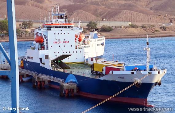
Bridge
Current StatusWhere is the vessel?
Bridge is currently in 10 nm E of OSMAN DIGNA, based on AIS data received about 1d ago.
Latest AIS update:
Current position: 19.16826° N, 37.53538° E (10 nm E of OSMAN DIGNA)
Average speed (last 7 days): Loading…
Average speed (last 30 days): Loading…
Vessel profile: Bridge is a Ro Ro Cargo Ship with dimensions 20m x 111m.
This page combines live AIS, route history, probable destination signals, nearby traffic, and port activity for practical vessel monitoring.
The current position of vessel Bridge is 19.16826 lat / 37.53538 lng. Updated: 2026-05-19 16:02:36 UTCNearest reference points:
- Near Port Sudan
- 53 nm SW of SHUAIBAH
- 99 nm SW of Al Qunfudah
Details:
Live Vessel Bridge Analytics (details, animations, etc.)
Recent AIS points (UTC):
2026-05-19 16:02:36 UTC · 19.16826, 37.53538 · SOG 9.3 kn · COG 264°2026-05-19 16:02:36 UTC · 19.16826, 37.53538 · SOG 9.3 kn · COG 264°
2026-05-19 16:02:36 UTC · 19.16826, 37.53538 · SOG 9.3 kn · COG 264°
2026-05-19 16:02:36 UTC · 19.16826, 37.53538 · SOG 9.3 kn · COG 264°