 vesseltracker.com
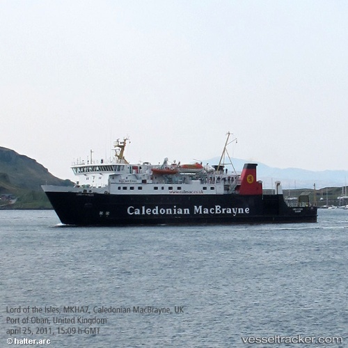
 Lord Of The Isles
Current Status
Where is the vessel?
Lord Of The Isles is currently in Near MALLAIG, based on AIS data received about 15h ago.
Latest AIS update:
Current position: 57.00738° N, 5.82614° W (Near MALLAIG)
Average speed (last 7 days): Loading…
Average speed (last 30 days): Loading…
Vessel profile: Lord Of The Isles is a Passenger Ro Ro Cargo Ship with dimensions 84m x 16m.
This page combines live AIS, route history, probable destination signals, nearby traffic, and port activity for practical vessel monitoring.
The current position of vessel Lord Of The Isles is 57.00738 lat / -5.82614 lng. Updated: 2026-05-18 11:22:49 UTCNearest reference points:
- Near KYLE OF LOCHALSH
- Near Fishnish, Isle of Mull
- Near CRAIGNURE PIER
Currently sailing under the flag of United Kingdom ![]()
Lord Of The Isles built in 1989 year
Deadweight:
464 tDetails:
Live Vessel Lord Of The Isles Analytics (details, animations, etc.)
Recent AIS points (UTC):
2026-05-18 08:20:01 UTC · 57.11923, -6.90705 · SOG 14.5 kn · COG 100°2026-05-18 09:42:17 UTC · 57.07305, -6.29896 · SOG 14.7 kn · COG 111°
2026-05-18 10:09:10 UTC · 57.02784, -6.11363 · SOG 14.7 kn · COG 118°
2026-05-18 11:22:49 UTC · 57.00738, -5.82614 · SOG 0 kn · COG 250°