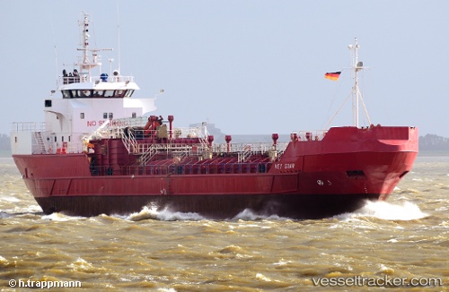
 NOR STAR
Current Status
Where is the vessel?
NOR STAR is currently in Near Flekkerøy, based on AIS data received about 14h ago.
Latest AIS update:
Current position: 57.96748° N, 8.06106° E (Near Flekkerøy)
Average speed (last 7 days): Loading…
Average speed (last 30 days): Loading…
Vessel profile: NOR STAR is a Chemical Tanker with dimensions m x m.
This page combines live AIS, route history, probable destination signals, nearby traffic, and port activity for practical vessel monitoring.
The current position of vessel NOR STAR is 57.96748 lat / 8.06106 lng. Updated: 2026-05-20 19:04:25 UTCNearest reference points:
- Near Kristiansand
- 27 nm N of HANSTHOLM
- Near HANSTHOLM
Currently sailing under the flag of Guinea ![]()
Details:
Live Vessel NOR STAR Analytics (details, animations, etc.)
Recent AIS points (UTC):
2026-05-20 16:25:25 UTC · 58.23798, 8.76252 · SOG 10.9 kn · COG 220°2026-05-20 16:26:04 UTC · 58.23647, 8.76012 · SOG 10.9 kn · COG 220°
2026-05-20 17:38:15 UTC · 58.09581, 8.45908 · SOG 10.4 kn · COG 230°
2026-05-20 19:04:25 UTC · 57.96748, 8.06106 · SOG 10.6 kn · COG 251°