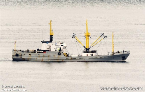
Rubinovyy
Current StatusWhere is the vessel?
Rubinovyy is currently in 59 nm E of SVETLAYA, based on AIS data received about 15h ago.
Latest AIS update:
Current position: 46.49667° N, 139.74167° E (59 nm E of SVETLAYA)
Average speed (last 7 days): Loading…
Average speed (last 30 days): Loading…
Vessel profile: Rubinovyy is a Fish Carrier with dimensions 9m x 54m.
This page combines live AIS, route history, probable destination signals, nearby traffic, and port activity for practical vessel monitoring.
The current position of vessel Rubinovyy is 46.49667 lat / 139.74167 lng. Updated: 2026-05-19 17:35:28 UTCNearest reference points:
- 40 nm NW of NEVELSK
- 45 nm S of Sovetskaya Gavan
- Near NEVELSK
Details:
Live Vessel Rubinovyy Analytics (details, animations, etc.)
Recent AIS points (UTC):
2026-05-19 13:50:33 UTC · 46.76500, 139.04333 · SOG 8 kn · COG -1°2026-05-19 16:08:29 UTC · 46.60167, 139.47166 · SOG 8 kn · COG -1°
2026-05-19 16:26:33 UTC · 46.57833, 139.52667 · SOG 8 kn · COG -1°
2026-05-19 17:35:28 UTC · 46.49667, 139.74167 · SOG 8 kn · COG -1°