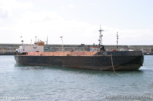
Varosa
Current StatusWhere is the vessel?
Varosa is currently in Near Vila Nova de Santo André, based on AIS data received about 1317d ago.
Latest AIS update:
Current position: 37.93390° N, 8.85385° W (Near Vila Nova de Santo André)
Average speed (last 7 days): Loading…
Average speed (last 30 days): Loading…
Vessel profile: Varosa is a Service Ship with dimensions 11m x 55m.
This page combines live AIS, route history, probable destination signals, nearby traffic, and port activity for practical vessel monitoring.
The current position of vessel Varosa is 37.93390 lat / -8.85385 lng. Updated: 2022-11-29 15:30:20 UTCNearest reference points:
- Near Sesimbra
- Near Palmela
- Near COVA DA PIEDADE
Details:
Live Vessel Varosa Analytics (details, animations, etc.)
Recent AIS points (UTC):
2022-11-29 15:30:20 UTC · 37.93390, -8.85385 · SOG 0 kn · COG 0°