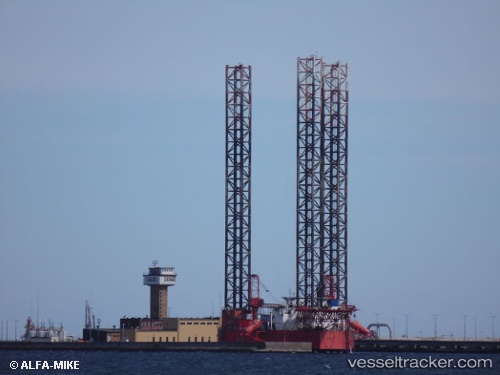
Petrobaltic
Current StatusWhere is the vessel?
Petrobaltic is currently in 14 nm N of Milobadz, based on AIS data received about 14h ago.
Latest AIS update:
Current position: 55.40035° N, 18.72339° E (14 nm N of Milobadz)
Average speed (last 7 days): Loading…
Average speed (last 30 days): Loading…
Vessel profile: Petrobaltic is a Drilling Ship with dimensions 51m x 65m.
This page combines live AIS, route history, probable destination signals, nearby traffic, and port activity for practical vessel monitoring.
The current position of vessel Petrobaltic is 55.40035 lat / 18.72339 lng. Updated: 2026-05-20 04:35:59 UTCNearest reference points:
- Near WLADYSLAWOWO
- Near Gdynia
- Near Sopot
Details:
Live Vessel Petrobaltic Analytics (details, animations, etc.)
Recent AIS points (UTC):
2026-05-20 01:02:56 UTC · 55.40041, 18.72337 · SOG 0 kn · COG -1°2026-05-20 02:03:41 UTC · 55.40039, 18.72341 · SOG 0 kn · COG -1°
2026-05-20 04:08:49 UTC · 55.40039, 18.72338 · SOG 0 kn · COG -1°
2026-05-20 04:35:59 UTC · 55.40035, 18.72339 · SOG 0 kn · COG -1°